


-

Chestnut Knob Trailhead
With the exception of the very steep ones, trails are built to accommodate park maintenance vehicles and as such are very wide for mountain trails. The trails are strewed with rocks and can be hard on shoes. The hike up Chestnut Knob trail is a path with several areas of steps to aid in climbing the steep climb. From the parking lot you walk .2 miles along a gravel road, which is the first part of the High Shoals Falls Loop Trail, to the trailhead of Chestnut Knob Trail. This picture was taken on the High Shoals Falls Loop Trail heading west and you can see the road in the left part of the picture which heads towards the falls.
-

Chestnut Knob Trail
The Chestnut Knob Trail is a mixture of steps, in steeper areas, and rocky mountain trail as shown in these three pictures. The steps are made from 4x4 beams which are also scattered along the trail to prevent runoff erosion. You can see one such beam in the picture below right. Also in that picture you can see the results of the November 2016 Wildfire.


-

Chestnut Knob Overlook
Unlike most overlooks that have a platform built with rails around it to prevent accidental falling down the mountain side this overlook is quite different. It is a rock outcropping that you make your way down from the peak via rugged terrain pictured to the left. This picture is looking back up the trail towards the peak. The picture below on the left is the rocky perch that you climb out on to look toward the falls, pictured to the right. I didnt think to take a picture of where I was sitting but it was a long ways down.


-
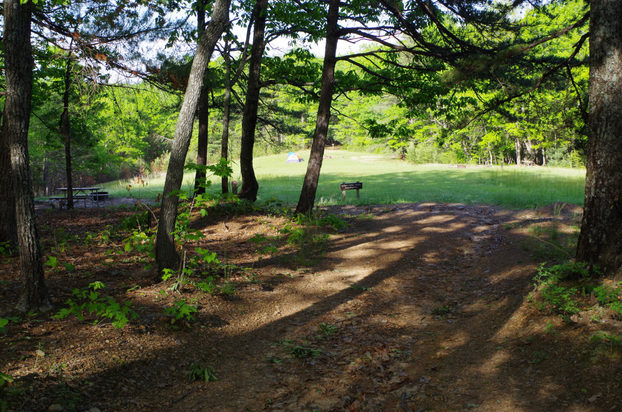
Sawtooth Camping Site
After approximately three hours of hiking we finally reach our destination. The campsite is an open grassy field with an outhouse situated back in the woods not far from our campsite. There are three designated campsites, each marked with a post and a number assigned to that site.


-

Sawtooth Camping Site (cont)
We reserved site number three, the far most area of the campsite. We were told it was closest to the water. The water turned out to be the Little River which was .2 miles north of the camp from the sign you see my brother next to in the picture to the left. It was a pleasant ten minute walk to the river but after three hours of hiking up to the top of Chestnut Knob it seemed to take forever to reach. I ventured down to the river to give my two gallon foldable vinyl water pail a test run and ended up with a half-gallon of water full of algae. Apparently it requires a deeper water source than the shallow Little River offered.
-

The Hike to the Parking Lot
After a brief rest we headed back to the parking lot to pick up my camera gear via the Upper CCC Trail and Little River Trail. Although not as steep as the Chestnut Knob Trail it was longer and took another three hours to reach the parking lot. The upper and lower CCC trails were named after the Civilian Conservation Corps which operated in the mountains back in the 1930s which developed the area which is now the South Mountain Park. We hiked to the falls and then headed back to camp via the Chestnut Knob trail.


-
Short Video
Not too long after we turned in the night birds began to sing. One bird was in the tree close to our tents. I believe it was a Whip-Poor-Will.It sang off and on most of the night and was very, very loud. This is a short clip, taken inside my tent looking out, of how loud that bird was.
-
Interpreting the Trail Signs
The Sign Interpretation pages are best viewed with the South Mountain Park Map (see below) opened in order to follow the numbers in the yellow circles on the map with the pictures of the signs. Click HERE to view those pages.
-

South Mountain Park Map
This map of South Mountain Park Trails has each area where the signs are posted highlighted with a yellow circle and a number which corresponds with the pictures of the signs in the Album and the Sign Interpretation pages above. This showcases the trails we took to and from the campsite. The hike to the falls is not shown on this map.